North Iceland is vast. That is the first thing to understand before you start planning.
Most first-time visitors never make it here. They fly in, do the Golden Circle, drive the south coast to Jökulsárlón, and fly home. The north stays on the to-do list for “next time” — which, for many people, never comes.
That is a shame, because north Iceland is where the country opens up. The crowds thin out. The waterfalls get bigger. The landscapes stretch further. And the character of the place shifts — it feels less like a postcard and more like a real, working part of Iceland.
This guide focuses on the corridor most travelers actually see when they do make it north: Akureyri, the Diamond Circle loop, the Mývatn area, and the Askja add-on for summer visitors with time to spare. The Tröll Peninsula, Siglufjörður, Skagaströnd, and the far northwest are worth their own guide — I will write that one separately.
What follows is a practical rundown: the sites, the activities, where to stay, and what actually works by season. I have guided this region many times, and I am giving you the real version, not the tourism-brochure one.
Akureyri: The Capital of the North
Akureyri is the gateway. Roughly 19,000 people live here, which makes it the second-largest urban area in Iceland, though that number only means something if you have already experienced how empty the rest of the country is.
It sits at the head of Eyjafjörður, the longest fjord in Iceland, surrounded by mountains that get properly snow-capped from October through May. The town itself is compact, walkable, and has a better café and restaurant scene than most people expect from a place this size.
What to See
The town center runs along Hafnarstræti and Ráðhústorg square. You can walk the whole thing in an hour, but the point is not really to sightsee — it is to have coffee, wander into a few shops, and get a feel for Iceland outside Reykjavík.
Akureyrarkirkja, the Lutheran church perched on the hillside, is the town’s most recognizable landmark. Built in 1940, designed by the same architect who did Hallgrímskirkja in Reykjavík (Guðjón Samúelsson). Worth the short climb up the steps for the view back over town and the fjord.
Lystigarðurinn, the botanical garden, is one of the northernmost botanical gardens in the world. It is small but surprisingly lush in summer, with a good mix of Icelandic and imported plants. Free entry. A nice 30–45 minute stop.
What to Do
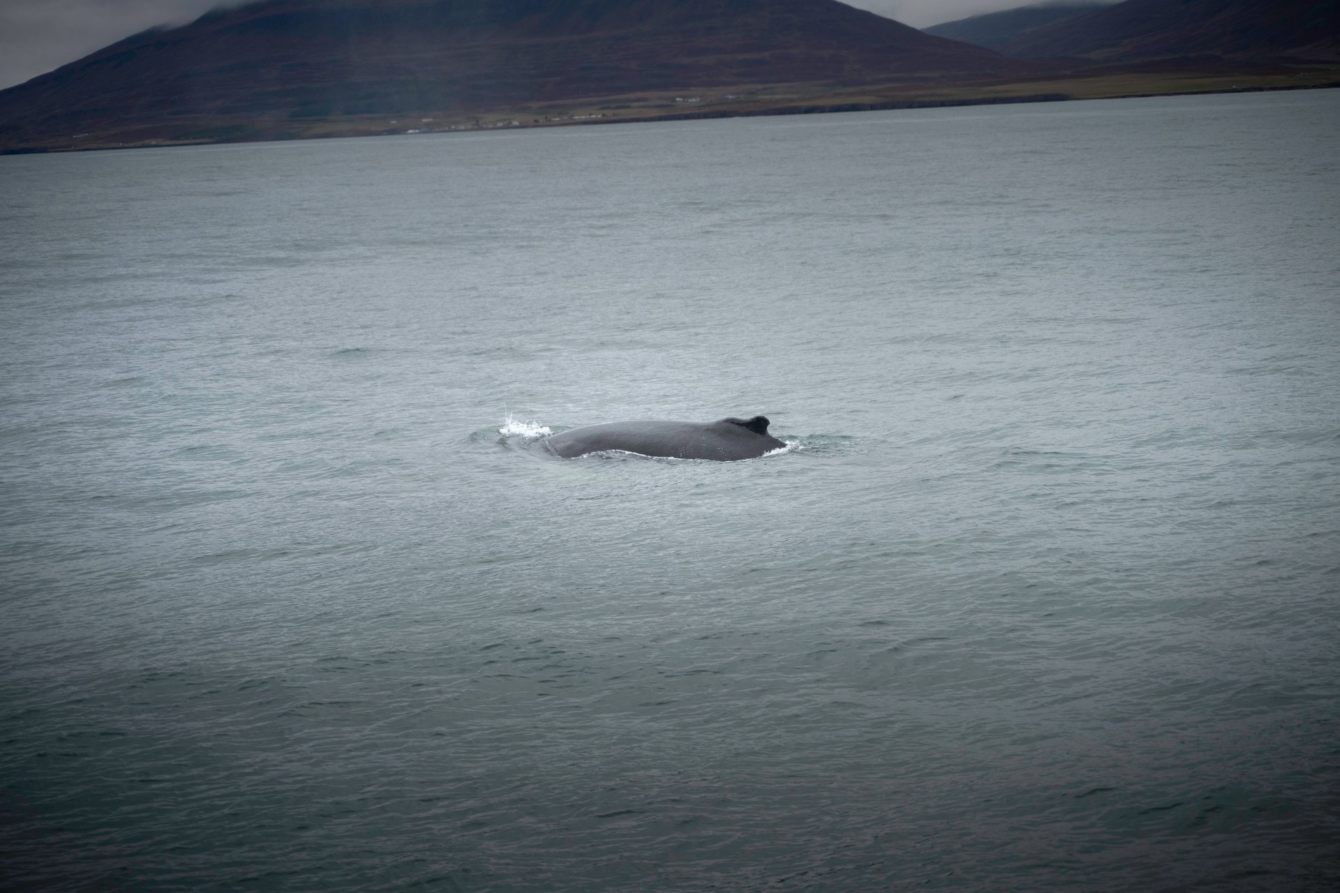
Whale watching is the main activity, though you usually head elsewhere for it. Húsavík, about an hour northeast of Akureyri, is widely considered the whale-watching capital of Iceland — sightings of humpbacks are close to guaranteed in summer. Dalvík, 40 minutes north, also offers solid trips and tends to be less booked up.
Skiing at Hlíðarfjall, the resort directly above the town, runs roughly from late November to late April depending on snow. It is not the Alps, but the runs are respectable, the lift tickets are cheap by European standards, and you are skiing with a view of the Arctic fjord. If you happen to be in Iceland in winter and want something different from the usual glacier-and-ice-cave routine, this is a genuinely good option.
Where to Stay
Akureyri has the full range of accommodation, from boutique hotels in the center to countryside options a short drive out. Further out, Deplar Farm on the Tröll Peninsula (about 90 minutes north) is in a different league entirely — it is one of the most exclusive properties in Iceland and deserves its own trip, not a one-night stop.
Winter Access
Fully operational year-round. The airport has daily flights from Reykjavík (45 minutes), which is the easiest way to reach the north in winter if you do not want to drive the ring road in snow.
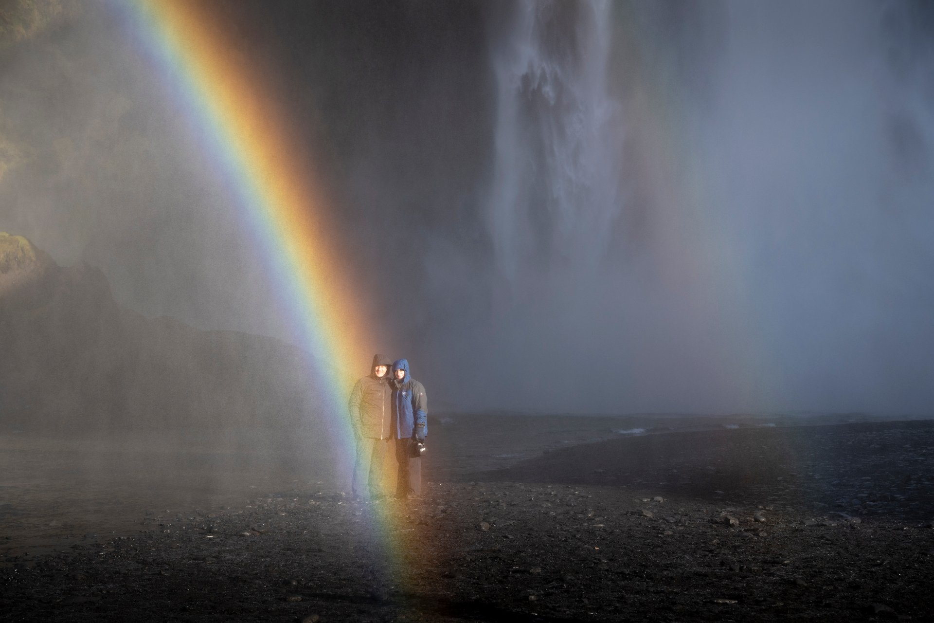
Góðafoss: The Waterfall of the Gods
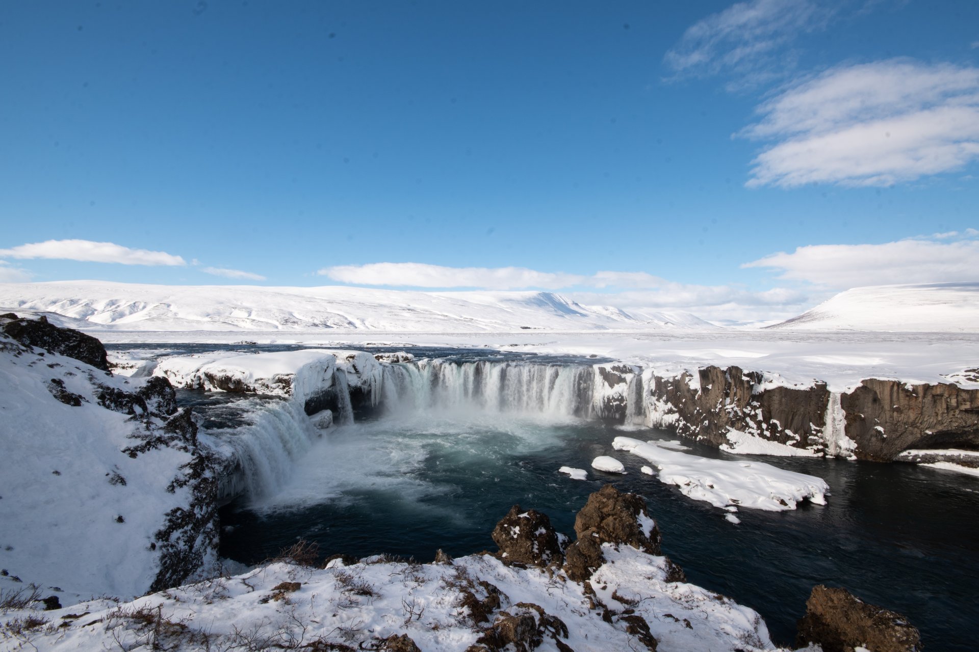
About 40 minutes east of Akureyri on the ring road, you will find Góðafoss.
The name translates to “Waterfall of the Gods,” and the story behind it is one of the more interesting pieces of Icelandic history. In the year 1000, when Iceland officially converted to Christianity, the lawspeaker Þorgeir Ljósvetningagoði is said to have thrown his pagan idols into this waterfall — a symbolic end to the old gods. Whether that literally happened is debated by historians. The name stuck regardless.
What to See
The waterfall itself is 12 meters high and about 30 meters wide, with two main curtains split by a small rock outcrop in the middle. It is not the tallest or most powerful waterfall in Iceland, but the horseshoe shape makes it one of the most photogenic. There are viewing platforms on both sides of the river — most visitors only see the east side, which is the first parking lot you reach, but the west side has better angles and fewer people.
What to Do
This is a stop, not a destination. Budget 45 minutes to an hour. Walk the paths on both sides if you have time, and in summer you can often get right up to the edge of the falls with a bit of careful footing. Good photography light is early morning or late afternoon.
Winter Access
Accessible year-round. In winter, the falls partially freeze, creating ice formations around the edges while water still flows through the center. This is genuinely one of the better winter waterfall photographs you can get in Iceland, but the paths get icy — crampons or good microspikes are worth having.
The Diamond Circle: Mývatn, Dettifoss, Ásbyrgi & Húsavík
The Diamond Circle is the route that ties most of north Iceland together into something you can reasonably see in two or three days. It loops from Akureyri through Góðafoss, down to Mývatn, northeast to Dettifoss and Ásbyrgi, up to Húsavík, and back to Akureyri — roughly 250 kilometers in total, though you will not do it in one day unless you want to spend it entirely in a car.
I usually break this into a two-night Mývatn base with day trips out to Dettifoss and up to Ásbyrgi, rather than trying to do it as a continuous loop. It gives you time to actually experience the places rather than just drive past them.
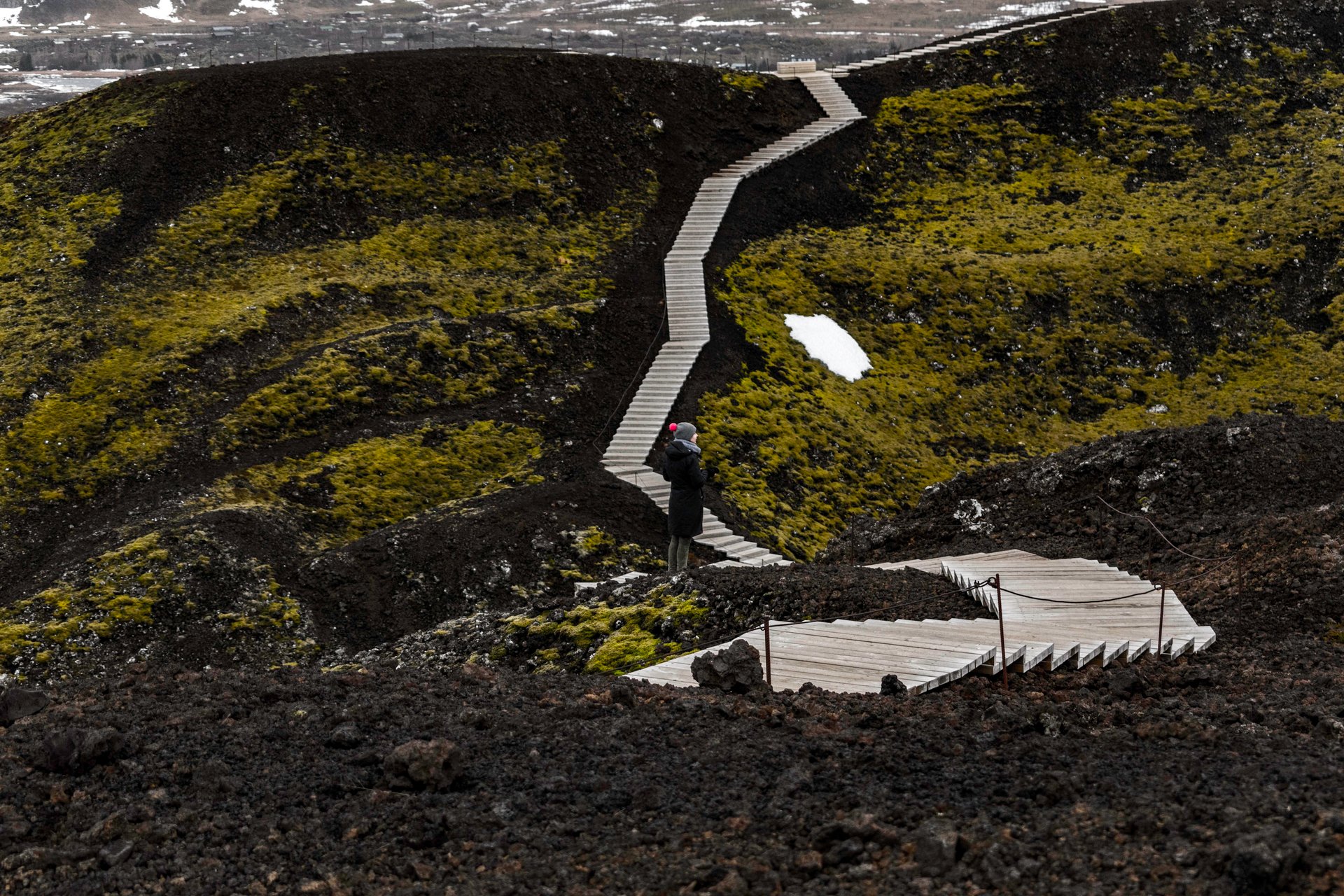
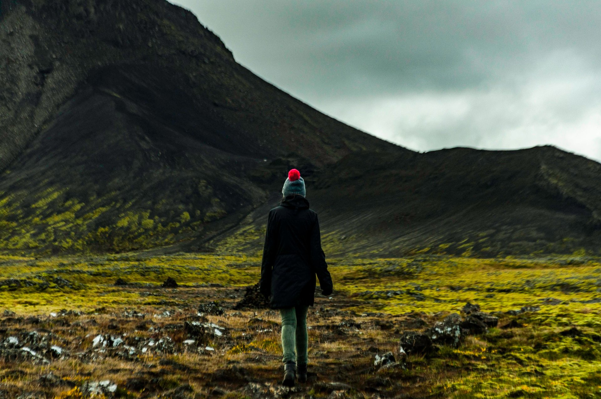
The Mývatn Area
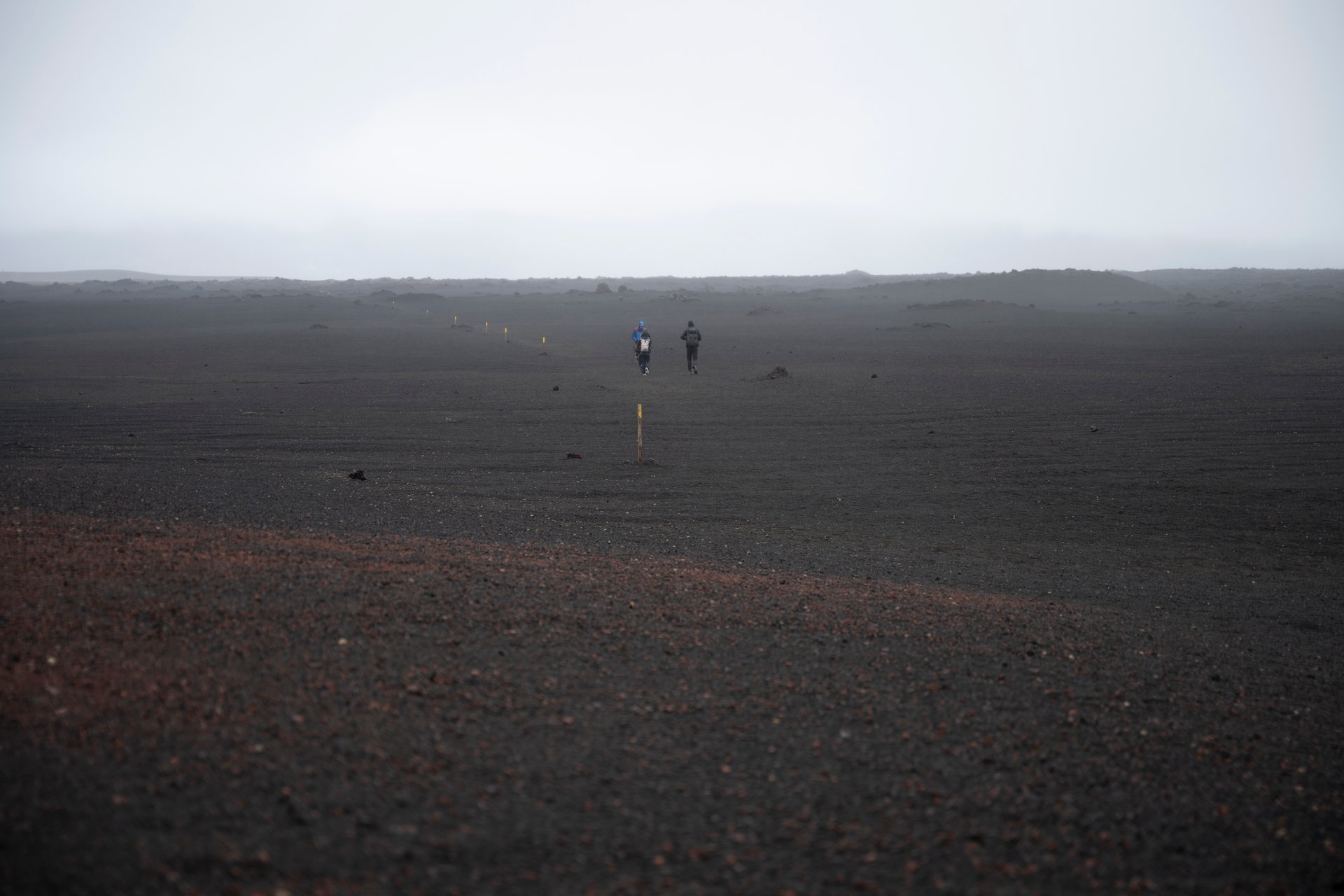
Mývatn is a shallow volcanic lake surrounded by some of the strangest geology in Iceland. The name means “midge lake,” which is unfortunately literal — in summer, the midges are aggressive. They do not bite, but they fly into your eyes and mouth constantly. A head net costs a few euros at any gas station in the area and is not optional between June and August.
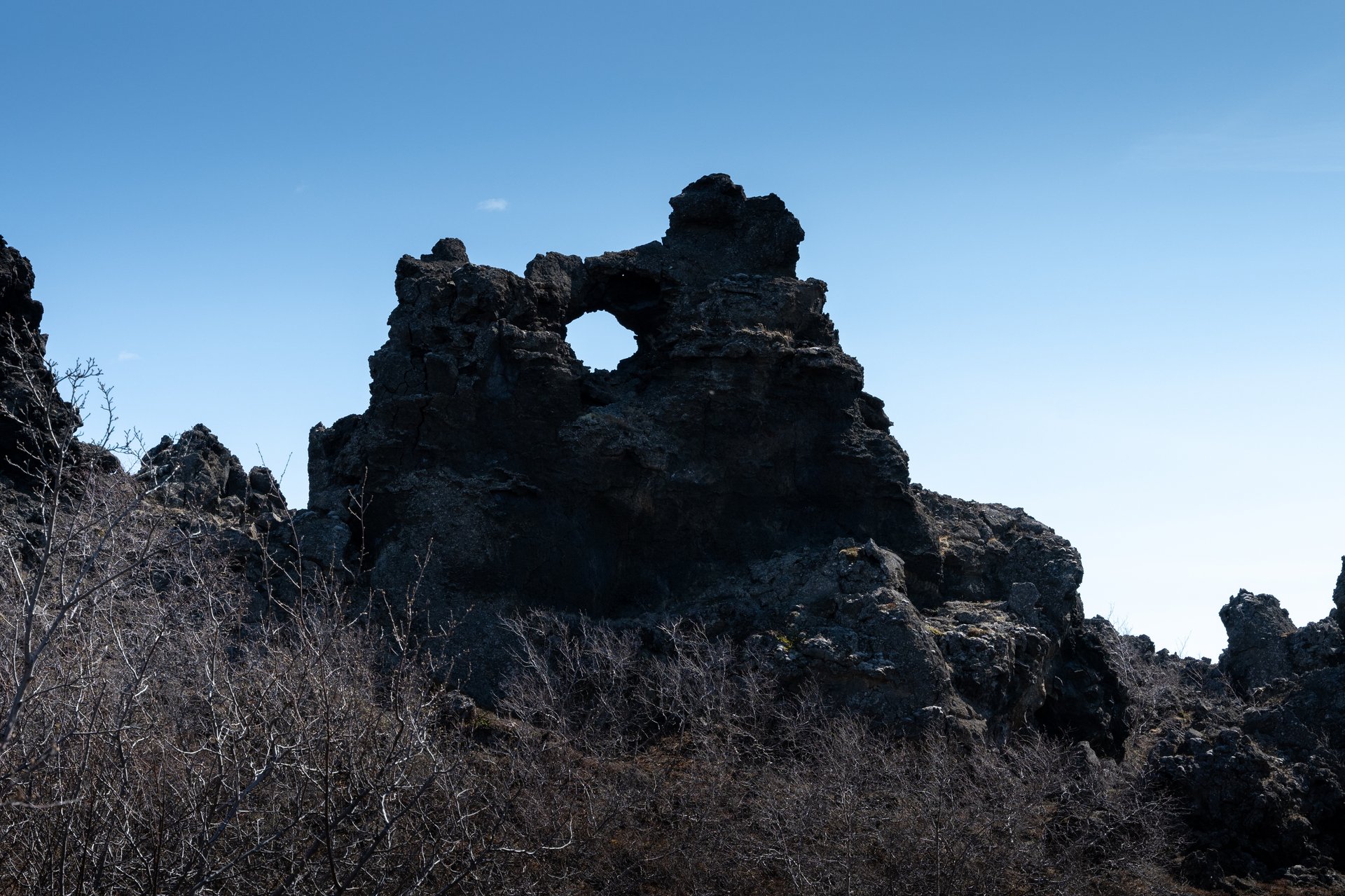
Dimmuborgir (“dark castles”) is a field of lava pillars and arches formed when lava flowed over a wetland, cooled rapidly, and left these hollow shapes behind. It is the kind of place that actually looks like photos of Iceland — black, jagged, otherworldly. Well-marked walking paths, easy to explore, allow 45 minutes to 1.5 hours depending on how far you walk.
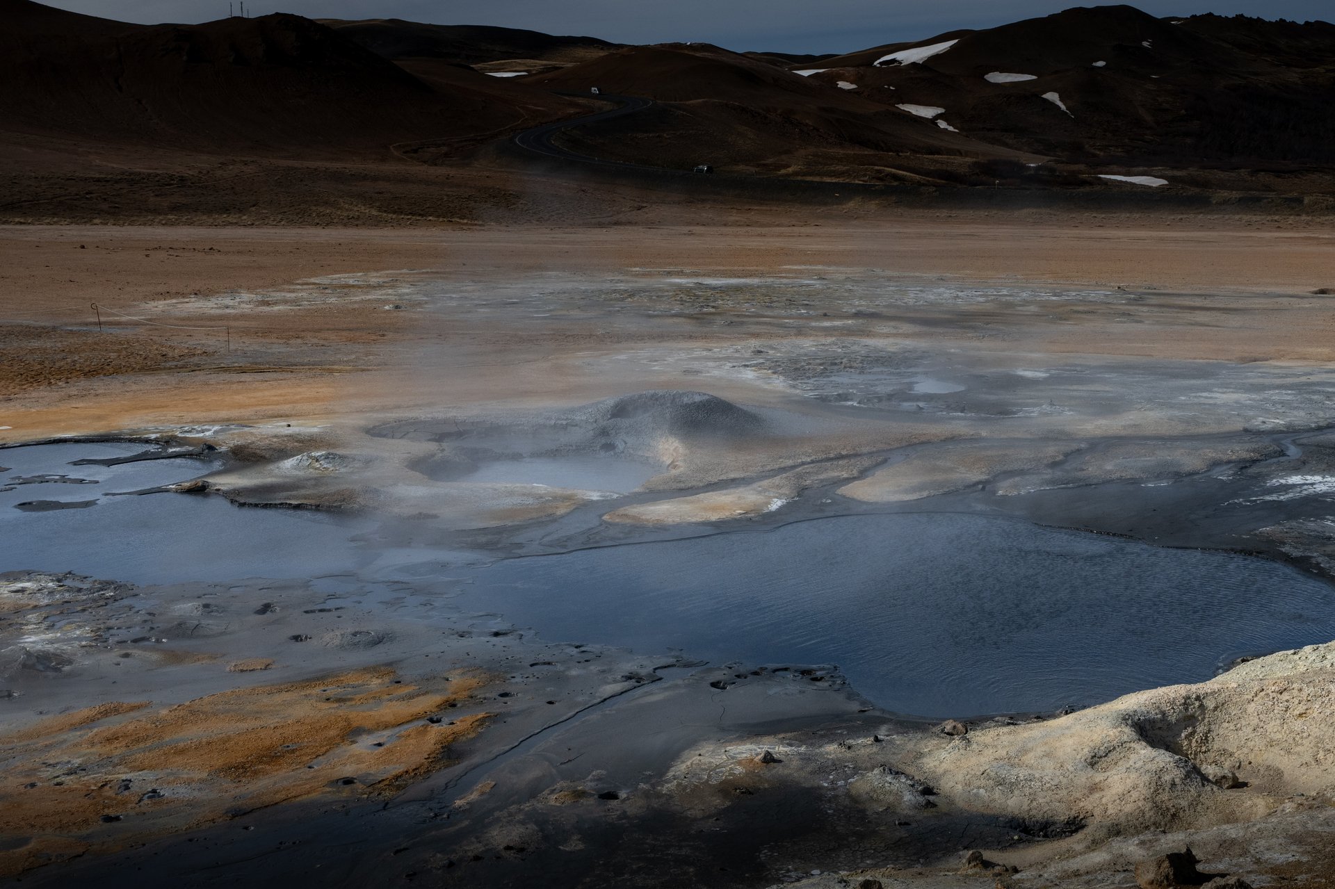
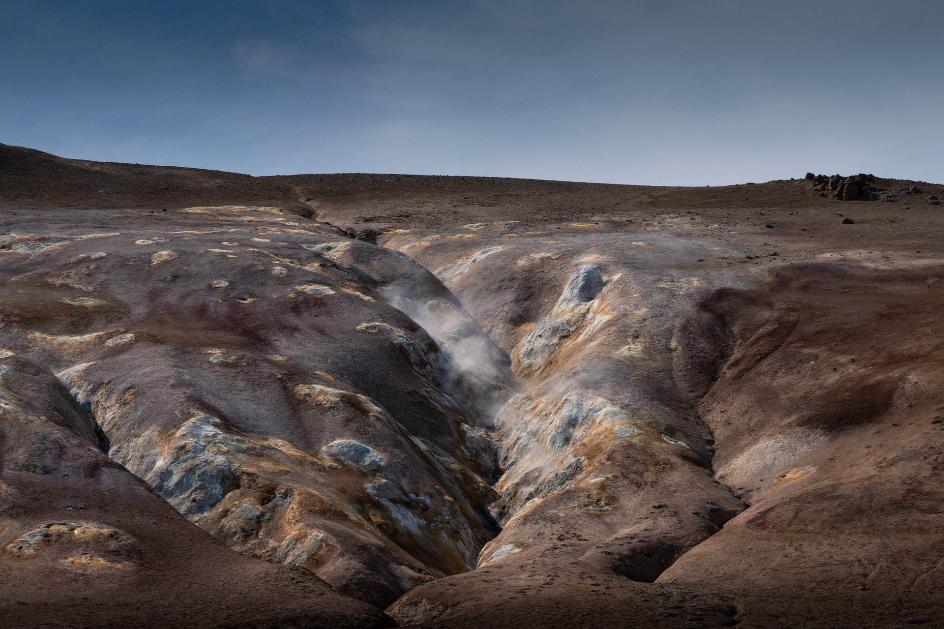
Námaskarð (also called Hverir) is the geothermal field on the east side of the lake. Boiling mud pots, sulfur vents, and ochre-stained ground. The smell is strong. It is also one of the easiest places in Iceland to see active geothermal activity up close — no hiking required, it is right off the main road.
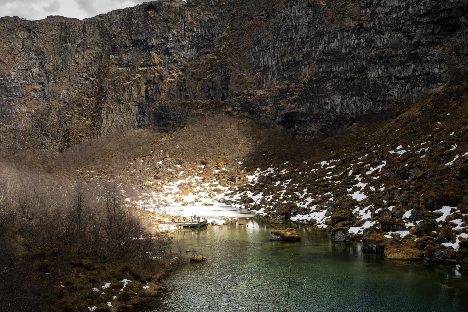
Grjótagjá is a small thermal cave with a bright blue pool inside. You may recognize it from Game of Thrones. You cannot swim in it anymore (the water temperature is too unpredictable after the Krafla volcanic activity of the 1970s–80s), but it is still worth a 15-minute stop for the view.
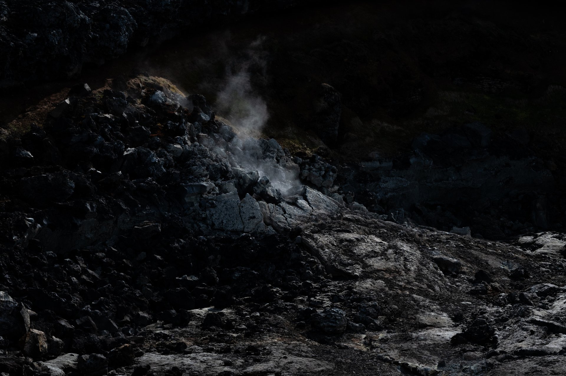
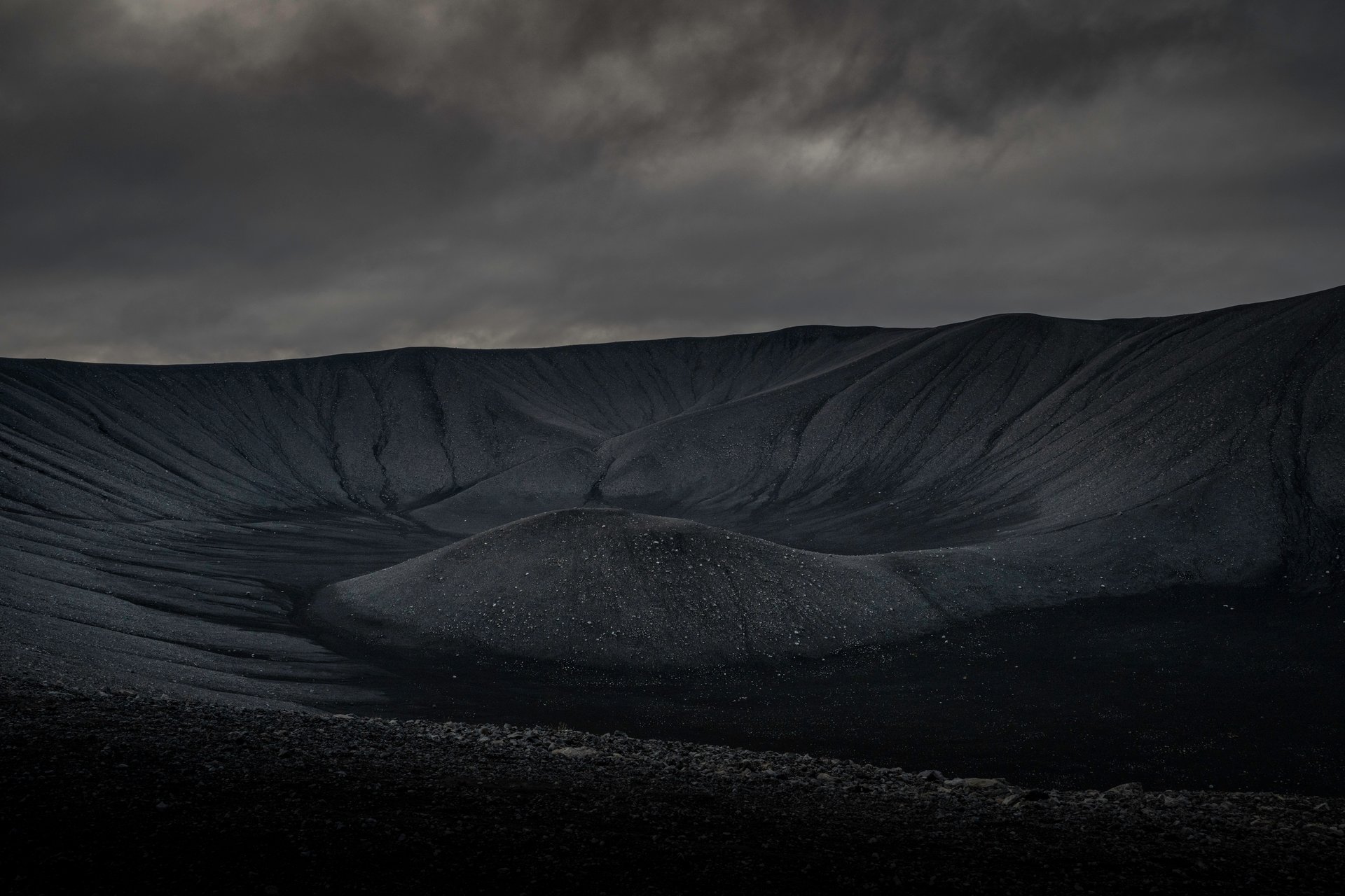
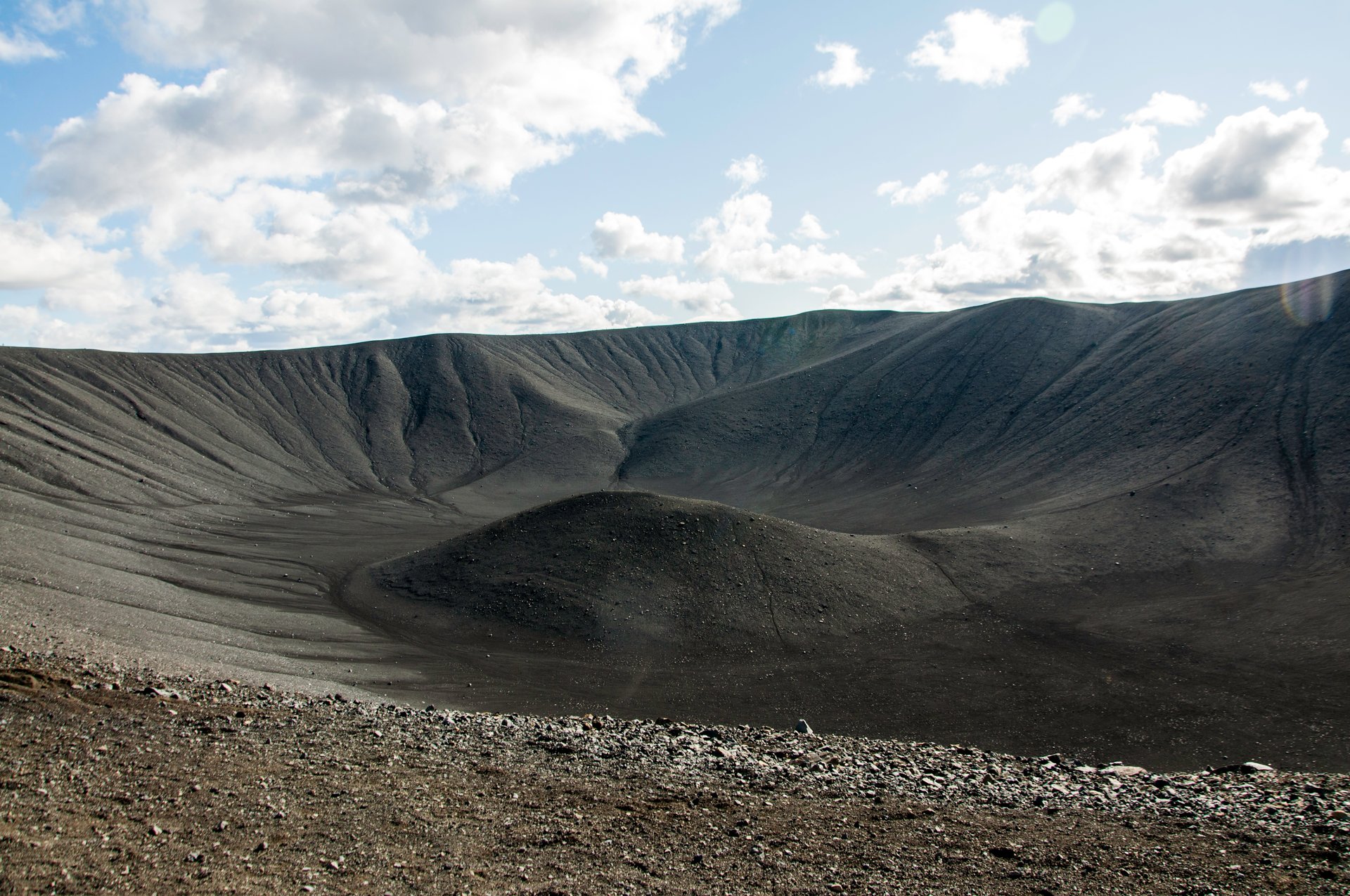
Leirhnjúkur is the short hike most people skip and shouldn’t. It is a 3-kilometer loop out and back across the lava field left by the Krafla Fires — nine volcanic eruptions between 1975 and 1984 that reshaped this whole area. The trail is flat, well-marked, and takes about an hour at a relaxed pace. What makes it worth the stop is that the lava is still steaming in places: you walk past vents hissing sulfur, ground that is warm under your boots, and black rock streaked with red and yellow mineral deposits. It is the most tangible recent-eruption landscape you can visit in north Iceland without a guide.
Krafla is the volcanic system to the north of the lake — active, still rumbling, and home to Víti crater (not to be confused with the Víti at Askja). A short hike gets you to the crater rim, which holds a bright blue-green lake. The nearby Krafla geothermal power station is also unexpectedly scenic, set against the steaming landscape.
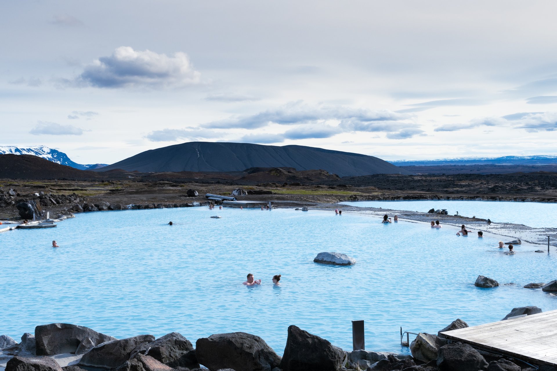
Mývatn Nature Baths is the region’s equivalent of the Blue Lagoon — geothermal waters, similar mineral composition, a fraction of the crowds, and a better view. If you have already been to the Blue Lagoon or have it planned, this is still worth doing. If you have not, this is a better experience. For more Icelandic bathing options, see our top 5 hot springs in Iceland.
Hotels: Hotel Laxá and FossHotel Mývatn are the two main options with a view of the lake. Both are comfortable, both have decent restaurants. Fosshotel Mývatn is newer and slightly more upmarket.
Winter: Fully accessible. The character changes completely — the lake freezes, the lava fields get dusted with snow, and it turns into one of the more cinematic winter landscapes in Iceland. The Nature Baths stay open year-round and are particularly good in winter.
Dettifoss & Selfoss
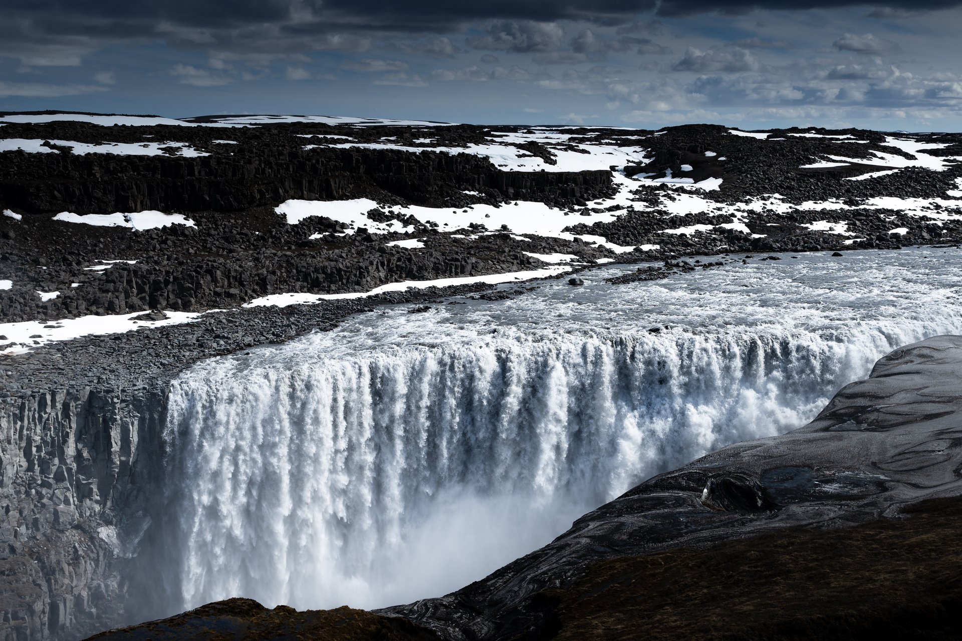
About 45 minutes northeast of Mývatn, Dettifoss is Europe’s most powerful waterfall by volume — roughly 193 cubic meters of water per second during peak summer flow. It is 100 meters wide, 44 meters tall, and utterly unlike any other waterfall in Iceland. The water is gray-brown with glacial sediment, the mist soaks you within minutes, and the ground vibrates.
There are two sides to approach from. The west side (Road 862) is paved and accessible year-round. The east side (Road 864) is gravel, closed in winter, and offers a more dramatic viewpoint closer to the falls — but it is also more dangerous in wet weather, with no guardrails on slippery basalt.
Selfoss is 15 minutes upstream from Dettifoss on the same river. Smaller in height (11 meters) but much wider and arguably more photogenic. Most visitors skip it. I always walk the extra 30 minutes.
Winter access: West side only, and still may be closed. East side closed. The waterfall partially freezes around the edges but the main flow continues through winter. For more waterfalls worth chasing across the country, see our 25 best waterfalls in Iceland.
Ásbyrgi Canyon
Continuing north from Dettifoss, you reach Ásbyrgi — a horseshoe-shaped canyon roughly 3.5 kilometers long, 1 kilometer wide, and 100 meters deep. According to Icelandic folklore, it was formed by the hoofprint of Odin’s eight-legged horse Sleipnir. Geologically, it was probably carved by catastrophic glacial floods (jökulhlaup) thousands of years ago.
It is a genuinely underrated stop. Quiet, green, protected from wind by the canyon walls, with a small pond at the back and easy walking trails. Good for a 1–2 hour stop. In summer, you will see nesting birds on the cliffs.
Húsavík
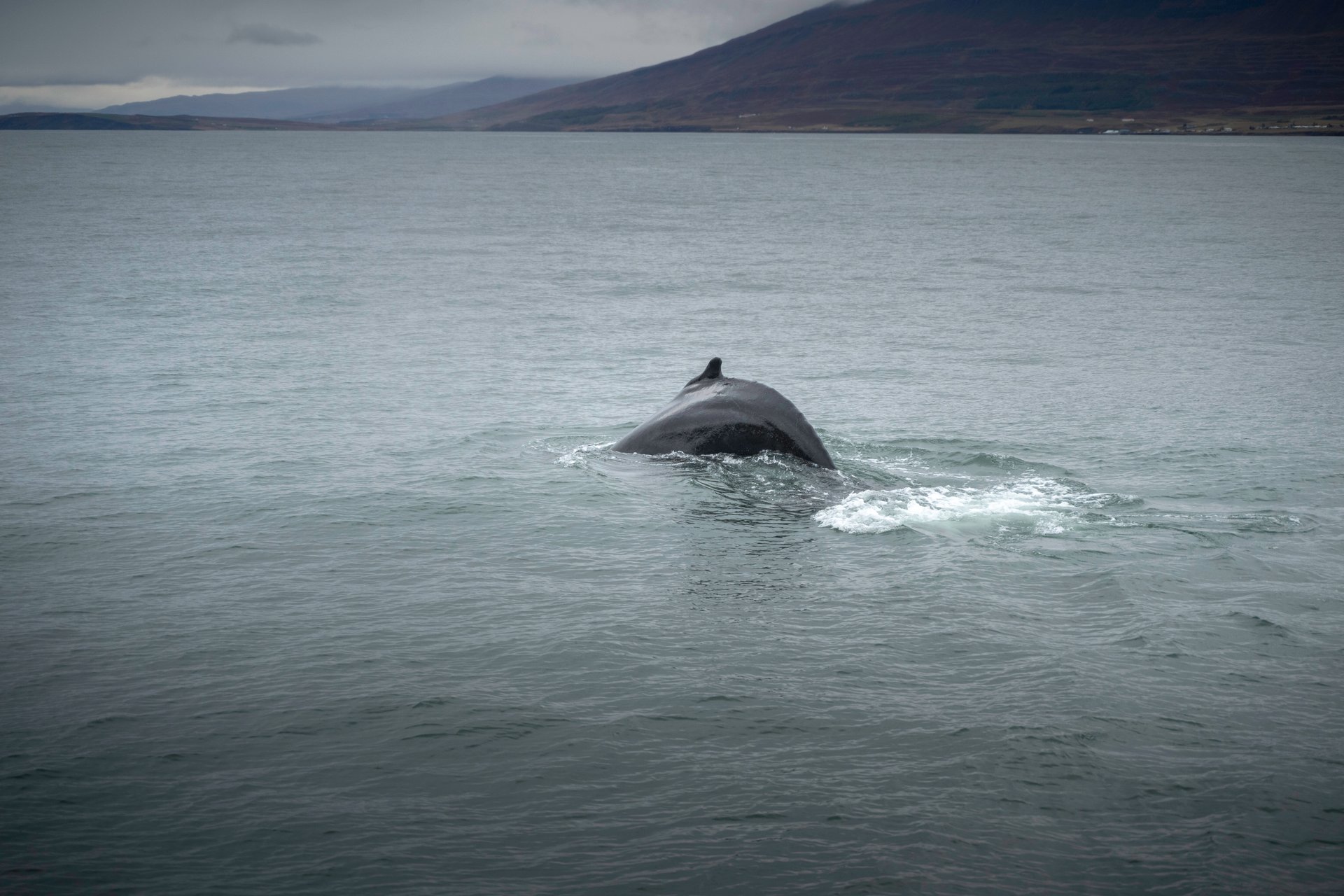
Húsavík is a small fishing town on the coast, about an hour north of Mývatn. Its reputation rests on whale watching — the sightings here are some of the most reliable in Iceland, and the town has leaned into it with a decent whale museum and several operators running trips.
It is also a pleasant place to stop for lunch. The harbor-front restaurants serve excellent fish, and the brightly painted wooden houses give the town more character than most Icelandic ports.
The Canyon Trail: Jökulsárgljúfur for Hikers
For visitors with more time and a serious hiking appetite, the canyon trail that runs from Ásbyrgi to Dettifoss through Jökulsárgljúfur National Park is one of the best multi-day hikes in Iceland.
The full route is roughly 34 kilometers and typically done in two days. It takes you along the rim and floor of the canyon carved by the Jökulsá á Fjöllum river, past waterfalls most people never see (Hafragilsfoss, Hljóðaklettar), and through landscapes that feel genuinely untouched.
This is not a casual hike. You need camping gear, decent hiking experience, and the ability to handle variable Arctic weather. Huts and designated campgrounds exist along the route, but facilities are basic.
Summer only. The trail is closed from roughly mid-September to early June. For most travelers I work with, this falls into the “worth knowing about, but not what you came here for” category. If you are a serious hiker, it deserves attention. If you are not, Ásbyrgi and Dettifoss as day stops will give you the scenery without the two-day commitment. If hiking is for you, compare against our 5 best hikes near Reykjavík.
Askja: Into the Highlands
Askja is a different proposition entirely.
It is not on the ring road. It is not on the Diamond Circle. It is deep in the Icelandic Highlands — about four hours from Mývatn on F-roads that cross unbridged rivers and require a proper 4x4 super jeep to reach. Which is exactly why most travelers never see it, and why those who do remember it.
What to See
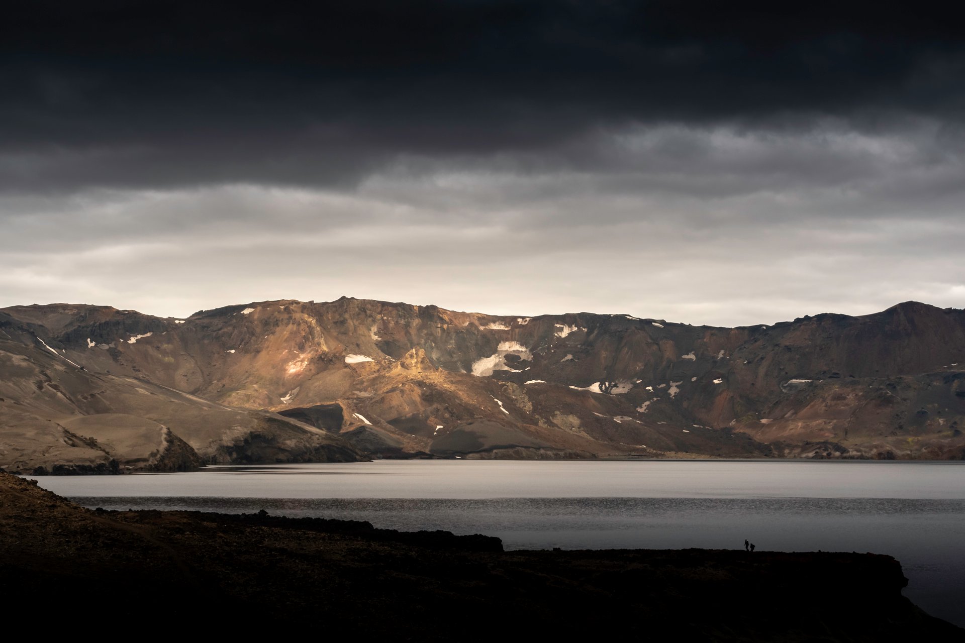
Askja is a massive volcanic caldera sitting inside the Dyngjufjöll mountains. The main caldera is about 8 kilometers across. At its southeastern corner, you will find Víti crater (yes, a different Víti than the one at Krafla). This Víti is filled with milky blue-green geothermal water.
The surrounding landscape is moon-like — NASA actually trained Apollo astronauts here in 1965 and 1967 because it was the closest analog they had for lunar geology.
What to Do
This is a super jeep day trip from Mývatn, not a destination with accommodation you build an itinerary around. The drive is long, the scenery changes constantly, and you need a guide who knows the river crossings — conditions vary week to week depending on glacial melt.
For travelers who have already seen the Highlands further south (Landmannalaugar, Thórsmörk), Askja is a genuinely different experience. It is rawer, emptier, and less photographed.
Winter Access
Completely inaccessible. The F-roads in this area are closed from early October to late June depending on the year. If Askja is on your list, you need to plan a summer trip — realistically mid-July through early September.
For the full picture on the Highlands in general, see our guide to the Icelandic Highlands.
When to Visit North Iceland
The north’s character changes more dramatically by season than almost any other part of Iceland.
Summer (June–August) is the obvious window for most visitors. Every site on this guide is accessible. Midnight sun means you can fit a lot more into each day. Roads to Askja open. The downside is midges at Mývatn and, to be honest, the main sites (Dettifoss in particular) do get busy in July and August — though still a fraction of what you see on the south coast.
Shoulder season (May & September) is my personal favorite. Sites are accessible, hotels are cheaper, you avoid the peak crowds, and the light quality — especially in September — is something the summer does not give you.
Winter (October–April) transforms the region. Askja and the Canyon Trail are out. The east side of Dettifoss closes. But Akureyri, the Mývatn area, Góðafoss, the Nature Baths, and the west side of Dettifoss all stay accessible. And the north is genuinely one of the best regions in Iceland for hunting the northern lights — less light pollution than the south, clearer skies on average, and the countryside hotels around Mývatn let you walk straight outside when the aurora appears.
How to Get There
Three options from Reykjavík:
-
Drive — About 5 hours on the ring road (388 km to Akureyri). Gorgeous in summer, demanding in winter. See our self-drive vs private tours comparison for an honest look at the tradeoffs.
-
Fly — Icelandair runs multiple daily flights from Reykjavík to Akureyri, about 45 minutes. Cheap by Iceland standards. Best option if you are short on time or traveling in winter.
-
Private multi-day tour — This is what I do for clients on longer itineraries, and it is the option I would recommend for most travelers who want to actually experience the north rather than just survive the drive.
Ready to Plan Your North Iceland Trip?
North Iceland rewards travelers who slow down. The Diamond Circle alone deserves two full days. Add Askja in summer, and you are looking at four to five days minimum just for the north — on top of whatever else you want to see in the country.
At Lilja Tours, we design and guide private multi-day trips that include north Iceland, either as a standalone focus or as part of a full ring road itinerary. Mercedes V-Class or Toyota Land Cruiser depending on the route, English-speaking guide who knows the terrain, and full flexibility to adjust each day based on weather and what you actually want to do.
If you are thinking about a trip that includes the north — particularly if Askja, Mývatn, or a winter northern lights focus is on your list — get in touch. I am happy to answer specific questions or help you work out whether the north makes sense for your timing.
North Iceland is not a place you check off. It is a place you come back to.
Frequently Asked Questions
How many days do I need for North Iceland?
Minimum two days for Akureyri and the Diamond Circle highlights. Three to four days lets you properly explore Mývatn, add Ásbyrgi and Húsavík, and take your time. Add two more days if you want to include Askja in summer.
Is North Iceland worth visiting in winter?
Yes, but with a different itinerary. Askja and the Canyon Trail are closed, but Akureyri, Mývatn, Góðafoss, and the west side of Dettifoss stay accessible. Winter in the north is excellent for northern lights, skiing at Hlíðarfjall, and visiting the Mývatn Nature Baths with snow on the ground.
What is the Diamond Circle?
A roughly 250-kilometer loop that covers Akureyri, Góðafoss, Mývatn, Dettifoss, Ásbyrgi, and Húsavík. It is the main touring route in North Iceland and can reasonably be done over two to three days.
Can I do North Iceland as a day trip from Reykjavík?
Not really. It is 5 hours each way by car, or 45 minutes by flight. A day trip by flight to Akureyri is possible but limits you to the town itself and perhaps Góðafoss. For the Diamond Circle or Mývatn, you need at least two days.
What is the best time to visit North Iceland?
Summer (June–August) for full access to everything including Askja. Shoulder season (May and September) for fewer crowds and good light. Winter (October–April) for northern lights, ice landscapes, and a quieter experience.